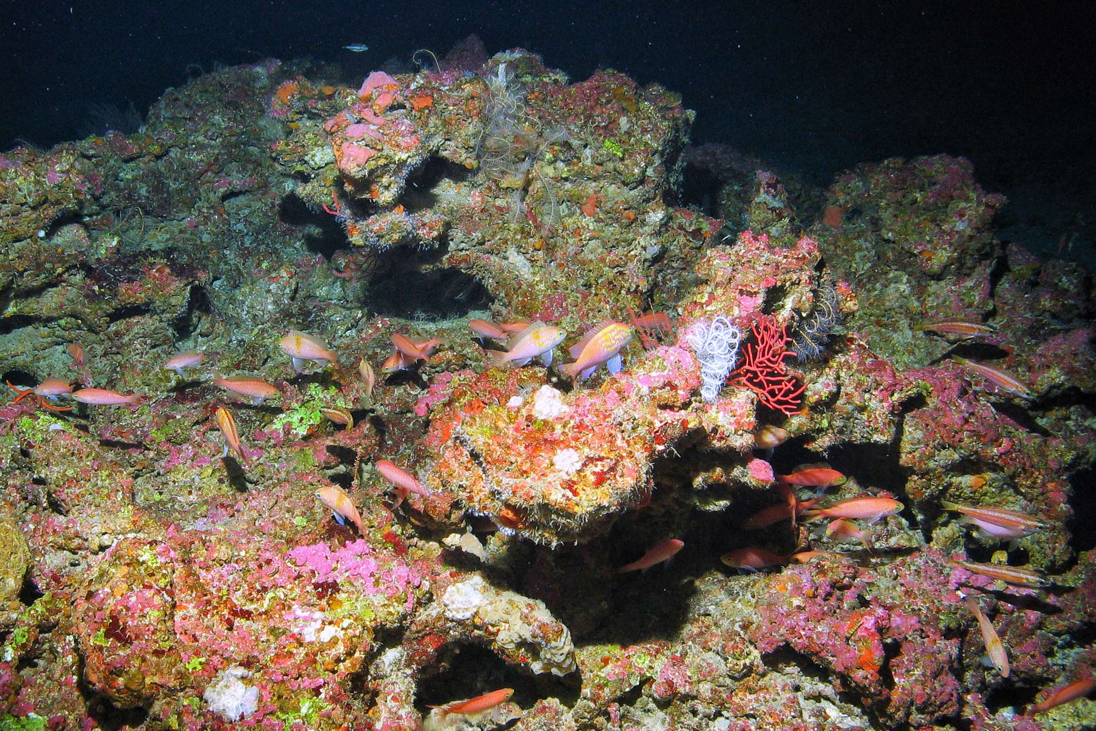
More than 770 square miles, or 2,000 square kilometers, of deep seafloor habitat surrounding the Deepwater Horizon oil well in the Gulf of Mexico were injured by the 2010 spill. Additionally, more than four square miles of the Pinnacles deep-sea reef complex, located at the edge of the continental shelf, were also injured by the spill.
Successful restoration of these low-light, hard-to-reach seafloor habitats, or mesophotic and deep benthic areas, requires detailed knowledge of the habitats and ecological communities there.
A new publication from the Open Ocean Trustees’ Mesophotic and Deep Benthic Communities (MDBC) restoration portfolio provides a detailed inventory of seafloor maps, ground-truthing data and predictive habitat modeling data. The compilation of these data resources represents a key milestone in supporting deep-sea restoration efforts near and around the site of the oil spill.
The inventory report (PDF, 89 pages) is available for download on the Gulf Spill Restoration website, as well as in the NOAA Institutional Repository’s collection of Mesophotic and Deep Benthic Communities publications.
Compiling the inventory involved gathering existing datasets for the northern Gulf of Mexico from 1980 through 2021 and integrating them with new data into a comprehensive collection.
The inventory includes:
- 693 seafloor mapping footprints
- 13,722 seafloor mapping tracklines
- 20 seafloor mapping derived products
- 737 seafloor mapping raster images
- 57 ground-truthing datasets, comprising 43 feature layers of ground-truthing surveys
- 12 predictive habitat modeling datasets, which included 198 model prediction layers
The associated dataset has been archived with NOAA’s National Centers for Environmental Information (NCEI) and is publicly available to download.
This collection makes several data resources available and provides critical information to guide efforts to map priority areas of the northern Gulf of Mexico seafloor that remain unmapped or poorly characterized. For example, the data are being used by the MDBC projects to guide field work and operations to document the abundance and locations of mesophotic deep benthic habitat for restoration. New information will be added to the inventory as data are collected.
The data is also supporting work by the Mapping, Ground-Truthing, and Predictive Habitat Modeling (MGM) project to develop habitat models to predict where mesophotic and deep benthic communities exist in the northern Gulf and create high resolution maps to inform restoration efforts now and in the future.
Background
Mesophotic and deep benthic communities were injured across a large area by the Deepwater Horizon oil spill. Due to the extent of the injury and the complexity of the habitats, these Mesophotic and Deep Benthic Communities activities were developed with significant input from the ocean management and scientific community. Four long-term restoration projects were developed, which complement each other and advance the ability to manage, protect, and restore these important Gulf of Mexico ecosystems.
Additional Resources
- Comprehensive Inventory of Seafloor Mapping, Ground-Truthing, and Predictive Habitat Modeling Datasets to Support Deepwater Horizon Mesophotic and Deep Benthic Communities (PDF, 89 pages)
- StoryMap: 2022 Mesophotic and Deep Benthic Communities Expeditions
We also send updates out via email. If you haven't already, please take the opportunity to sign up for e-mail updates today to receive the latest news from all the Deepwater Horizon Trustees.